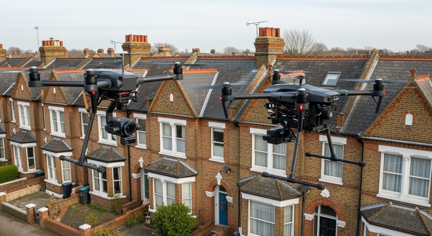
Drone technology is revolutionising property surveys across Essex, providing unprecedented access to roofs, chimneys, and hard-to-reach areas without the need for ladders, scaffolding, or expensive access equipment. This technological advancement is transforming how RICS chartered surveyors conduct building inspections, offering safer, more comprehensive, and cost-effective assessments.
At Chelmsford Surveyors, we've integrated cutting-edge UAV (Unmanned Aerial Vehicle) technology into our surveying practice, enabling us to capture high-resolution imagery and detailed footage of building exteriors that would previously have required costly access arrangements or remained unexamined due to safety constraints.
Contents
The Drone Survey Revolution
Transforming Traditional Surveying
Traditional property surveys often relied on visual inspections from ground level, with surveyors unable to closely examine roofs, chimneys, and upper-level details. Drone technology has eliminated these limitations, providing detailed aerial perspectives that reveal defects and conditions previously hidden from view.
Traditional Survey Limitations
- Ground-level observations only: Limited visibility of roof condition and upper-floor details
- Safety constraints: Dangerous or impossible access to steep roofs and high chimney stacks
- Cost barriers: Expensive scaffolding or specialist access equipment requirements
- Time constraints: Limited inspection window due to access arrangements
Drone Survey Advantages
- 360-degree aerial access: Complete visual coverage of all building elevations
- Enhanced safety: No physical access to dangerous areas required
- Cost-effective: Eliminates expensive access equipment and specialist contractors
- Rapid deployment: Quick setup and comprehensive coverage in minimal time
Advanced Technology Capabilities
High-Resolution Imaging
- • 4K UHD video recording capability
- • 20+ megapixel still photography
- • RAW format capture for detailed analysis
- • Gimbal-stabilised cameras for sharp imagery
- • Multiple angle documentation
- • Macro-level detail capture
Thermal Imaging Integration
- • FLIR thermal cameras for heat loss detection
- • Insulation gap identification
- • Moisture ingress mapping
- • Energy efficiency assessment
- • Solar panel performance analysis
- • Building fabric thermal bridging
3D Mapping & Modelling
- • Photogrammetry 3D model creation
- • Accurate dimensional measurements
- • Interactive 3D building models
- • Point cloud data generation
- • Progress monitoring capability
- • CAD-ready survey data
Interactive Drone Survey Technology Guide
4K Cameras
Thermal Imaging
GPS Precision
AI Analysis
Roof Inspection Benefits
Roof inspection represents the primary application of drone technology in property surveys. Essex properties, particularly Victorian and Edwardian houses with complex roof structures, benefit enormously from aerial assessment capabilities that reveal conditions invisible from ground level.
Detailed Roof Assessment Coverage
Slate and Tile Condition
Individual slate security, cracked tiles, nail sickness indicators, and weather damage assessment across entire roof area.
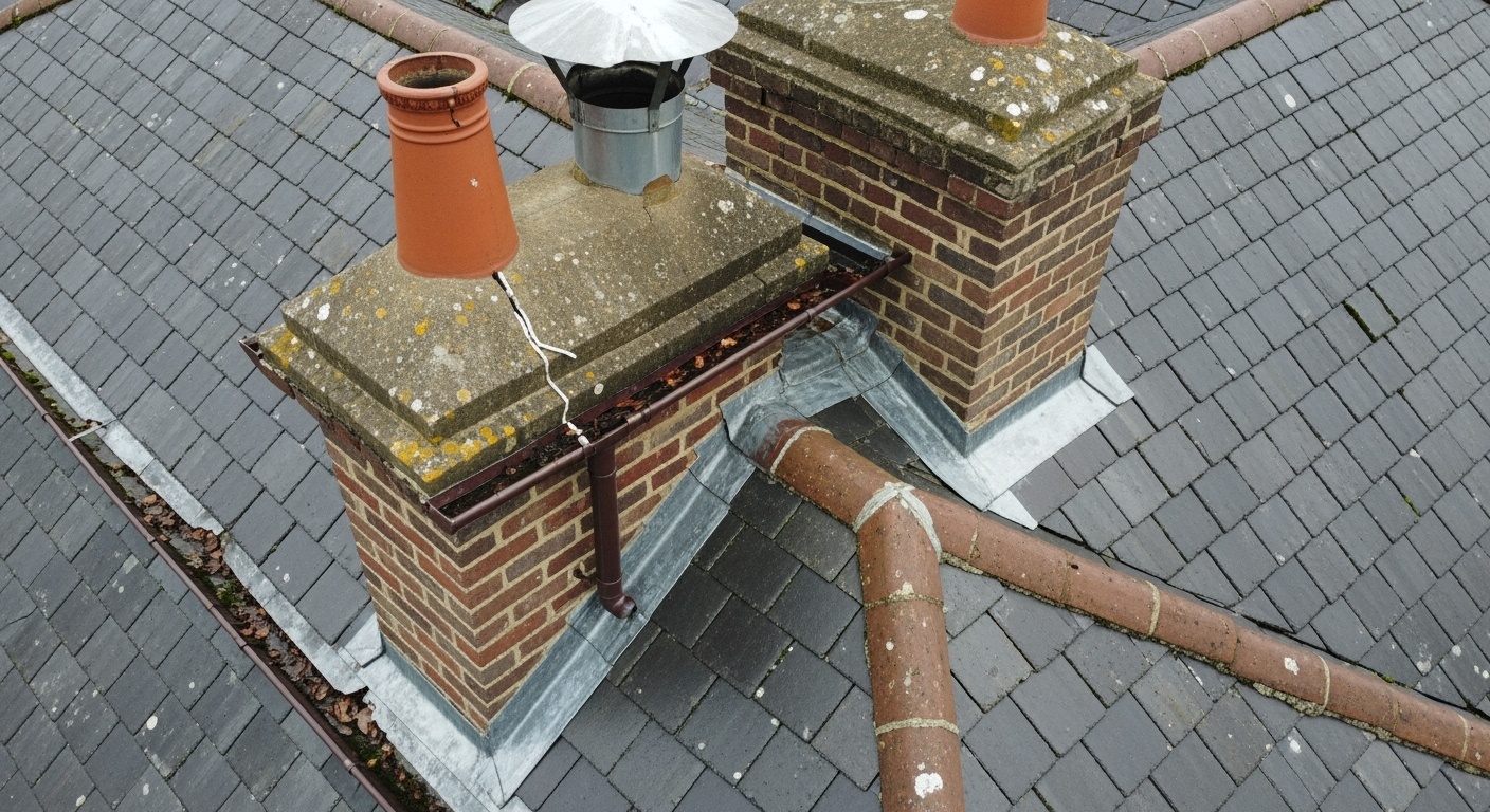
Chimney Stack Evaluation
Pointing condition, stack stability, pot security, and flashing integrity examination from multiple angles.
Gutter and Drainage Systems
Blocked gutters, downpipe condition, overflow issues, and rainwater goods deterioration documentation.
Ridge and Verge Details
Ridge tile security, mortar pointing condition, and verge tile displacement assessment along entire roof perimeter.
Specific Defect Detection
Common Issues Identified:
- Loose or displaced slates requiring immediate attention
- Lead flashing failures around chimney bases
- Structural timber exposure indicating slate loss
- Moss and vegetation growth causing drainage blockages
- Solar panel mounting system integrity and roof impact
Cost Comparison: Drone vs Traditional Access
Traditional Scaffolding:
- • Setup cost: £800-£2,000
- • Daily hire: £150-£300
- • Safety requirements
- • Weather dependent
- • Planning permissions may be required
Drone Survey:
- • Survey cost: £300-£800
- • Same-day completion
- • Minimal safety risk
- • Weather flexible
- • No planning required
Additional Benefits:
- • Complete photographic record
- • Multiple angle documentation
- • Thermal imaging capability
- • 3D mapping potential
- • Future comparison baseline
Safety and Efficiency Gains
Enhanced Safety Protocols
Drone surveys eliminate the need for surveyors to access dangerous roof areas, reducing insurance liabilities and health & safety risks significantly.
Risk Elimination:
- • No ladder access to fragile slate roofs
- • Eliminates fall risks from height
- • No structural loading on weak roof areas
- • Weather-independent inspection capability
Insurance Benefits:
- • Reduced professional indemnity premiums
- • Lower health & safety compliance costs
- • Elimination of access-related accident claims
Operational Efficiency
Drone technology significantly reduces survey duration while simultaneously increasing the comprehensiveness and detail of property assessments.
Time Savings:
- • Complete roof survey in 30-45 minutes
- • No setup/breakdown time for access equipment
- • Simultaneous data capture and documentation
- • Real-time issue identification
Quality Improvements:
- • Consistent, repeatable flight paths
- • Standardised data capture protocols
- • Enhanced client reporting capabilities
Case Study: Victorian Terrace Survey Efficiency
Traditional Method:
- • Ground-level observation only
- • Limited roof detail available
- • Estimate: 3-4 hours on-site
- • Additional costs for access
- • Weather-dependent scheduling
Drone-Enhanced Method:
- • Complete 360° roof coverage
- • High-resolution defect documentation
- • Total time: 90 minutes on-site
- • No additional access costs
- • Flexible weather windows
Result: 60% reduction in survey time while providing 300% more detailed roof documentation, with enhanced client satisfaction and reduced survey costs.
Applications Across Property Types
Drone surveys provide valuable insights across all property types in Essex, from period cottages to modern commercial developments. Each property category presents unique survey challenges that drone technology helps overcome.
Residential Properties
Victorian/Edwardian Houses:
- • Complex roof valley intersections
- • Multiple chimney stack assessments
- • Bay window roof condition
- • Lead flashing integrity checks
Modern Developments:
- • Solar panel installation impacts
- • UPVC gutter condition
- • Insulation thermal bridging
- • Flat roof membrane condition
Commercial Buildings
Office Buildings:
- • Large flat roof membrane surveys
- • HVAC equipment condition assessment
- • Parapet wall structural integrity
- • Safety barrier compliance checks
Industrial Units:
- • Extensive roof light condition
- • Cladding panel security assessment
- • Gutter capacity and drainage
- • Height-access safety compliance
Specialist Properties
Listed Buildings:
- • Heritage roof material condition
- • Conservation area compliance
- • Original feature preservation
- • Minimal intervention assessments
Agricultural Buildings:
- • Large span roof structure condition
- • Asbestos-containing material surveys
- • Ventilation system assessments
- • Conversion potential evaluations
Survey Outcomes by Property Type
Essex Case Studies
Case Study 1: Victorian Terrace in Great Baddow
Property Type: 1890s Victorian end-of-terrace • Survey Type: RICS Level 3 with drone enhancement
Challenge:
Three-storey Victorian house with complex roof line including dormers, multiple chimneys, and suspected slate issues. Traditional ground-level inspection inadequate due to height and complexity.
Drone Survey Findings:
- • 15 loose slates requiring immediate attention
- • Lead flashing failure around rear chimney
- • Blocked dormer gutters causing overflow
- • Original Victorian ridge tiles in excellent condition
Client Impact:
Purchase price negotiated down £8,000 based on detailed roof condition evidence. Immediate repair priorities clearly identified with photographic evidence.
Cost Savings:
- • Avoided £1,500 scaffolding costs
- • Prevented £12,000 emergency roof repairs
- • Negotiated purchase price reduction
- • Insurance claim documentation provided
Case Study 2: Commercial Office Building, Chelmsford
Property Type: 1980s office building • Survey Type: Dilapidations assessment
Challenge:
Large flat roof areas with HVAC equipment, safety concerns for manual inspection, and requirement for detailed photographic evidence for landlord dilapidations claim.
Drone Survey Results:
- • Comprehensive flat roof membrane assessment
- • HVAC unit support frame deterioration identified
- • Parapet wall pointing failures documented
- • Safety barrier compliance issues recorded
Commercial Outcome:
Detailed photographic evidence supported £45,000 dilapidations claim. Clear responsibility allocation between landlord and tenant based on condition evidence.
Professional Benefits:
- • Zero health & safety incidents
- • Comprehensive documentation for legal proceedings
- • Rapid survey completion (2 hours vs 2 days)
- • Client cost savings exceeded £15,000
Choosing a Drone-Enabled Surveyor
Professional Expertise Requirements
"Drone technology is only as effective as the professional operating it. When selecting a surveyor for drone-enhanced inspections, ensure they combine RICS qualification with CAA drone certification and comprehensive insurance coverage. The technology amplifies expertise rather than replacing it – you need both technical competence and surveying knowledge for meaningful results."
Essential Qualifications
- ✓ RICS Chartered Surveyor status
- ✓ CAA drone pilot licence (A2 CofC minimum)
- ✓ Professional indemnity insurance covering drone operations
- ✓ Operational authorisation for commercial flights
- ✓ Regular training and competency updates
- ✓ Equipment maintenance and calibration records
Technical Capabilities
- ✓ High-resolution 4K camera systems
- ✓ Thermal imaging capabilities
- ✓ GPS precision mapping technology
- ✓ Weather monitoring and flight planning
- ✓ Real-time data processing capabilities
- ✓ Secure data storage and client confidentiality
Service Standards
- ✓ Comprehensive pre-flight risk assessments
- ✓ Detailed survey reporting with imagery
- ✓ Client consultation and findings explanation
- ✓ Follow-up recommendations and prioritisation
- ✓ Integration with traditional survey methods
- ✓ Transparent pricing and no hidden costs
Why Choose Chelmsford Surveyors for Drone Surveys?
Advanced Drone Technology
- • Professional DJI Mavic 3 Enterprise with thermal imaging
- • CAA licensed pilots with commercial authorisation
- • Comprehensive insurance coverage up to £6 million
- • Real-time data processing and analysis capabilities
RICS Professional Standards
- • Combined 150+ years surveying experience
- • Integration of drone data with traditional survey methods
- • Detailed reporting with prioritised recommendations
- • Expert interpretation of technical findings
Conclusion: The Future is Aerial
Drone technology has fundamentally transformed property surveying across Essex, providing unprecedented access to building details while enhancing safety, efficiency, and cost-effectiveness. For property buyers, sellers, and owners, drone surveys offer comprehensive insights that were previously impossible or prohibitively expensive to obtain.
The integration of high-resolution imaging, thermal analysis, and 3D mapping capabilities creates a powerful toolkit for property assessment. When combined with traditional RICS surveying expertise, drone technology delivers thorough, accurate, and actionable building condition reports.
As the technology continues to evolve with AI-powered analysis, enhanced sensor capabilities, and automated flight planning, drone surveys will become even more valuable for property decisions. The future of building assessment is aerial, safer, and more comprehensive than ever before.